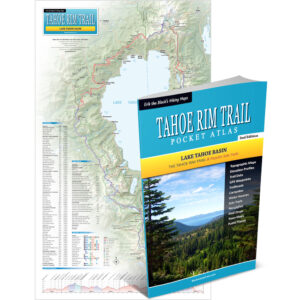
Tahoe Rim Trail Maps & The Essential Trail Data You Need To Hike, Bike or Ride The 171 Mile Trail Around Lake Tahoe… In One Pocket-Size Book!
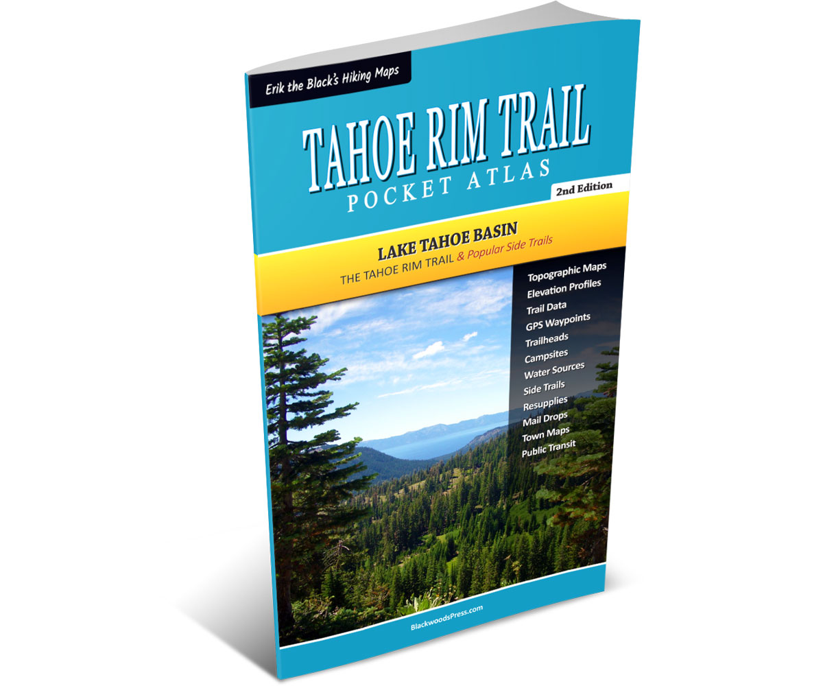
Tahoe Rim Trail Pocket Atlas
By “Erik the Black” Asorson
Original price was: $29.95.$24.95Current price is: $24.95.
Save: $5.00 (17%)
FREE SHIPPING: USPS Ground (3-7 business days)
Features
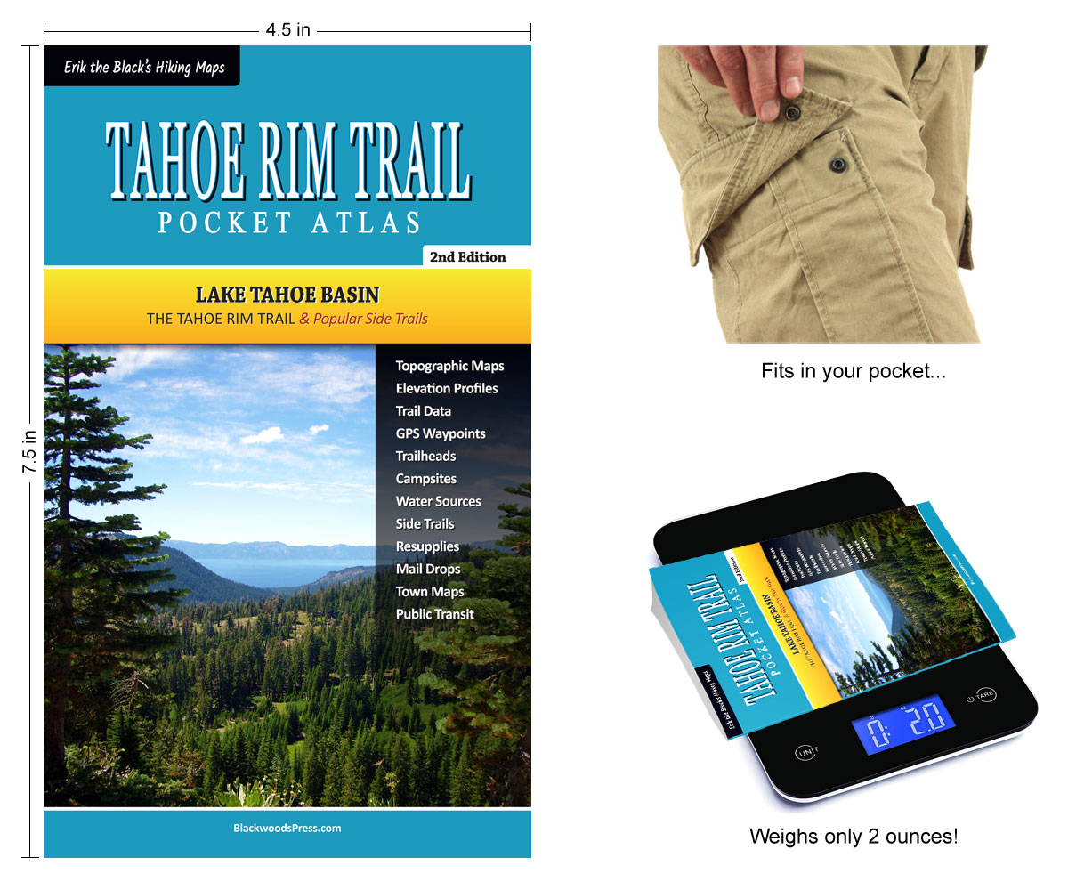
- Pocket-Size Guidebook: Tahoe Rim Trail Pocket Atlas measures 4.5 x 7.5 x 0.1 inches and weighs just 2 ounces
- Tahoe Rim Trail Maps: Detailed maps for the entire 171 mile trail (plus side trails and alternate routes)
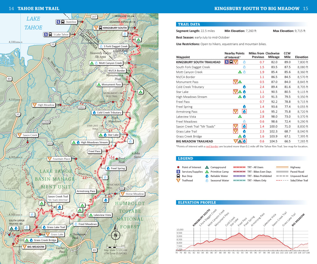
- Points of Interest: Campsites, water sources, trailheads and other important features marked on the maps
- Mileage and Elevation Data: For important waypoints and points of interest along the Tahoe Rim Trail
- Elevation Profiles: See all the peaks, passes and valleys along the route, so you can plan for the big climbs
- Resupply Guide: Trail towns, resupply locations, maildrops and hiker services near the Tahoe Rim Trail
- GPS Data: Download a GPX file containing the waypoints from the book, to use with your Smartphone or GPS
Product Details
Title: Tahoe Rim Trail Pocket Atlas
Publisher: Blackwoods Press, 2nd edition
Paperback: 32 pages
Dimensions: 4.5 x 7.5 x 0.1 inches
Weight: 1.7 ounces
ISBN: 978-1-7367279-0-4
From the Author: My Tahoe Rim Trail Pocket Atlas packs all the maps and essential data you need to hike, bike or ride the Tahoe Rim Trail around Lake Tahoe into one pocket-size booklet. If you like to know where you’re going, but don’t like packing heavy guidebooks or big floppy maps, then this minimalist TRT guide is for you!

Happy trails,
Author, Cartographer, Thru-hiker
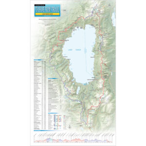
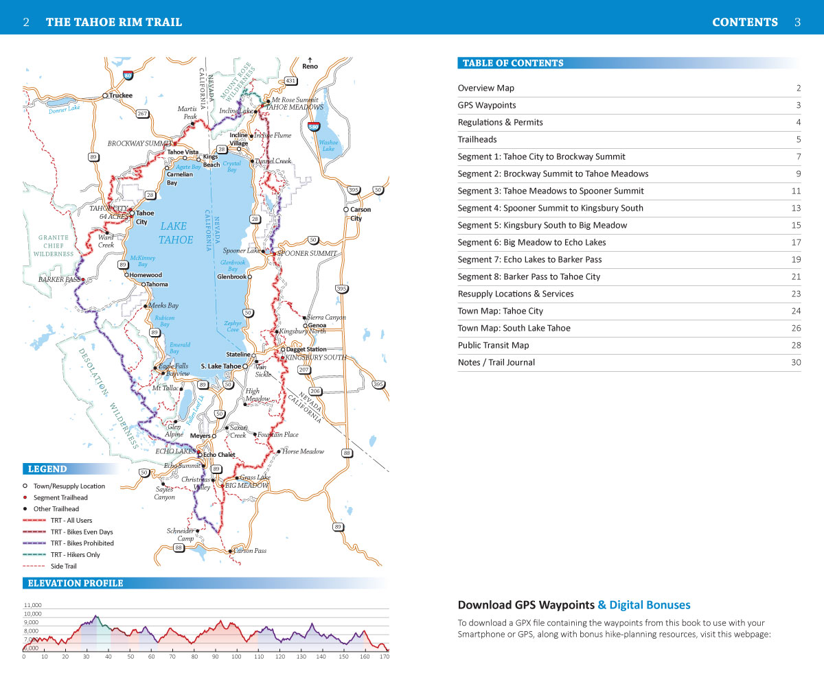
Tahoe Rim Trail Maps With Mileage & Elevation Data
Plus: Water Sources, Campsites, Trailheads & More
Erik the Black’s Tahoe Rim Trail Maps show the entire 171 mile Tahoe Rim Trail around Lake Tahoe, annotated with mileage and elevation data for hundreds of important waypoints and points of interest – in an easy to read two-page format.
Plus Essential Information To Help You Plan Your Hike
Resupply Guide, Town Maps, Public Transit, Permits & More
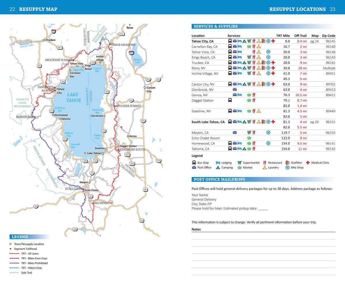
Tahoe Rim Trail Resupply Guide
Resupply Guide lists all the trail towns and resupply locations near the Tahoe Rim Trail, how to get there, and which services you can expect to find at each location.
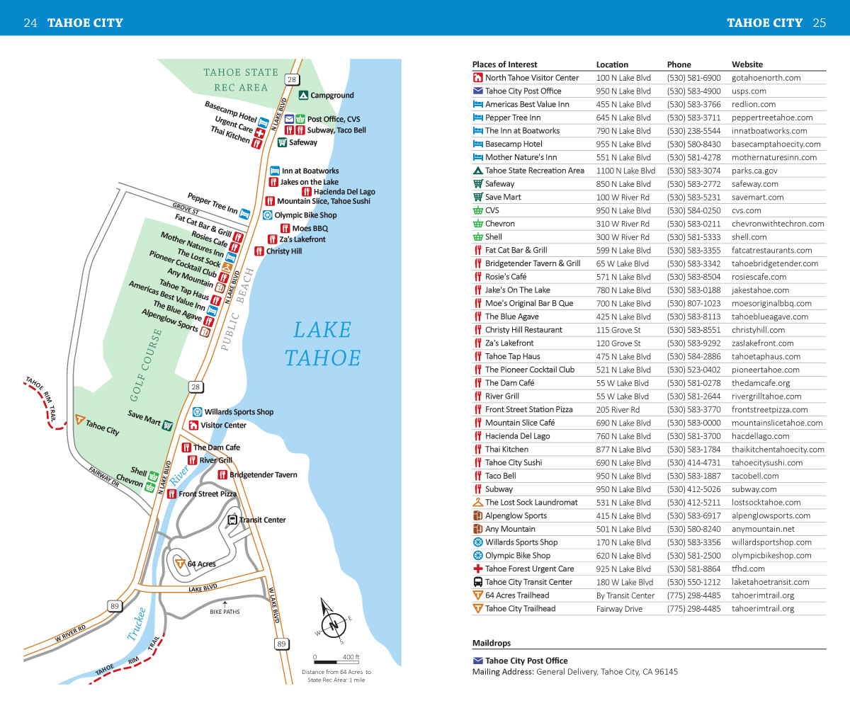
Tahoe Rim Trail Town Maps
Town Maps show the layout of trail towns and where to find essential hiker services, including: post offices, hotels, groceries, restaurants, outfitters and more.
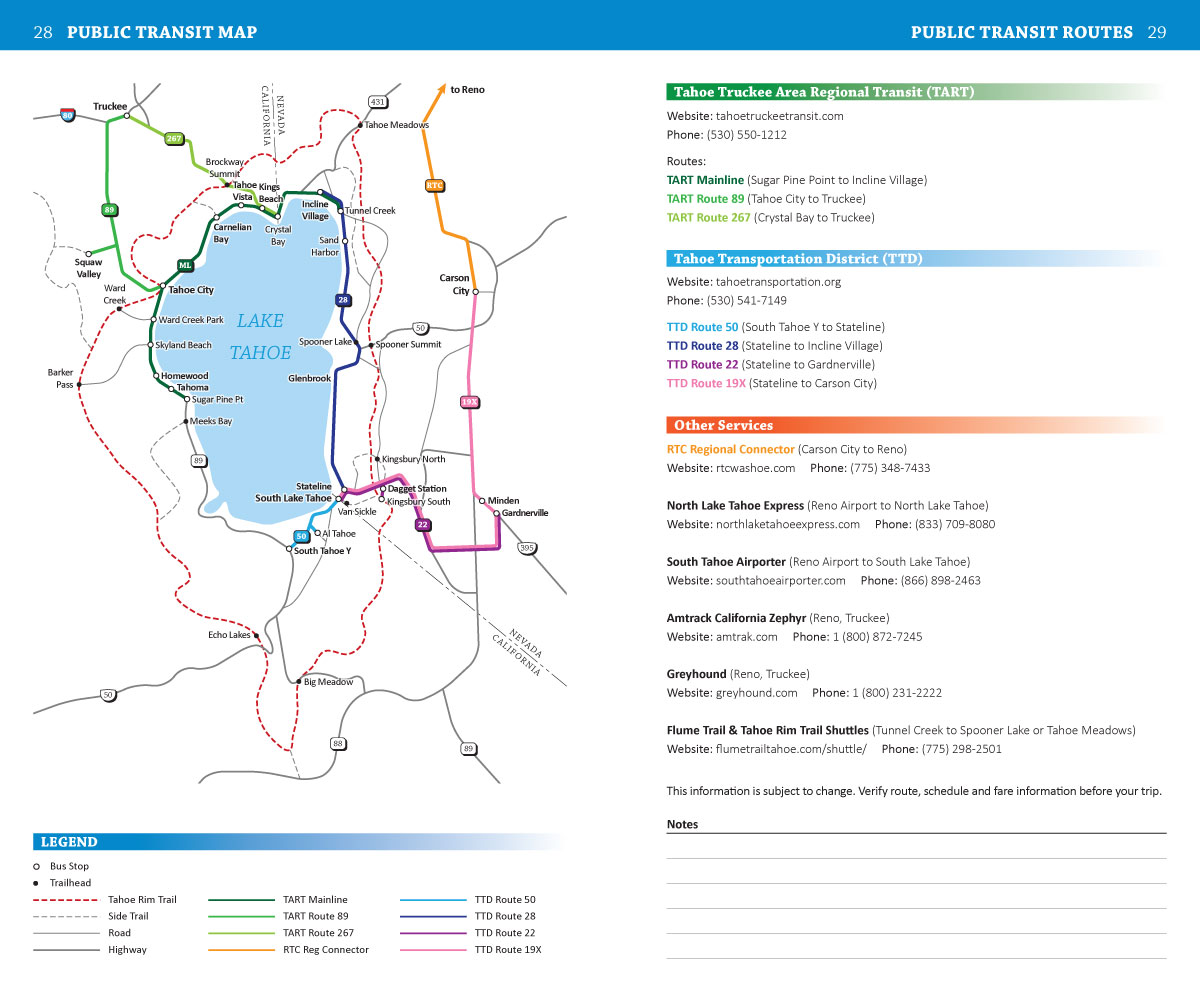
Tahoe Rim Trail Public Transit Map
Public Transit Map shows bus and shuttle routes in the area, and how they can be used to link the Tahoe Rim Trail with nearby towns (either directly or via side trails.)
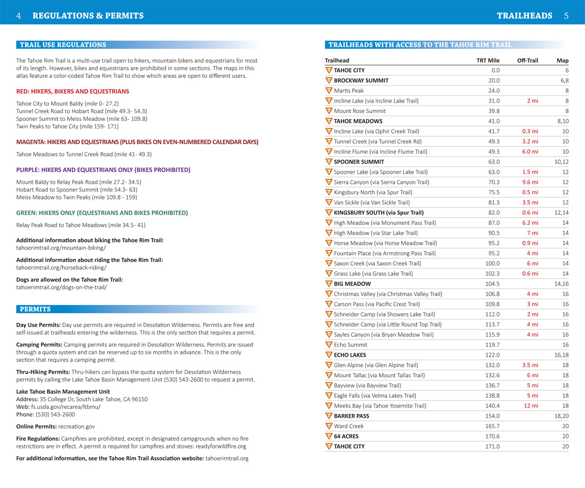
Tahoe Rim Trail Trailheads & Permits

Trailhead & Permit Info covers which trail segments are open to hikers, bikers and equestrians, permit requirements and the trailheads you can use to access the TRT.
All Packed Into a Pocket-Size Tahoe Rim Trail Guidebook
Measures 4.5 x 7.5 inches and Weighs Just 2 ounces
Tahoe Rim Trail Pocket Atlas measures 4.5 x 7.5 x 0.1 inches and weighs just 2 ounces. It’s lightweight, easy to pack and contains all the maps and essential information you will need to plan your hike and successfully navigate the Tahoe Rim Trail.
Start Planning Your Tahoe Rim Trail Adventure!
Order Your Tahoe Rim Trail Pocket Guide Here:

Tahoe Rim Trail Pocket Atlas
Paperback, 2nd Edition
Original price was: $29.95.$24.95Current price is: $24.95.
Save: $5.00 (17%)
30 day money back satisfaction guarantee
FREE SHIPPING: USPS Ground (3-7 business days)